

LaPaz County
AZGenWeb

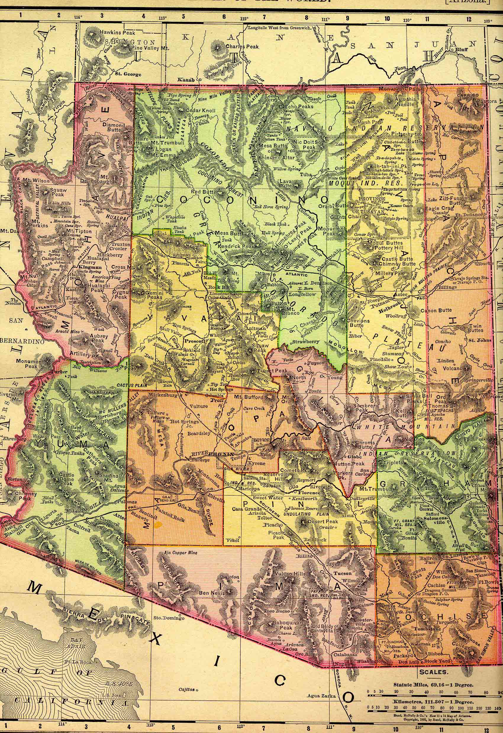
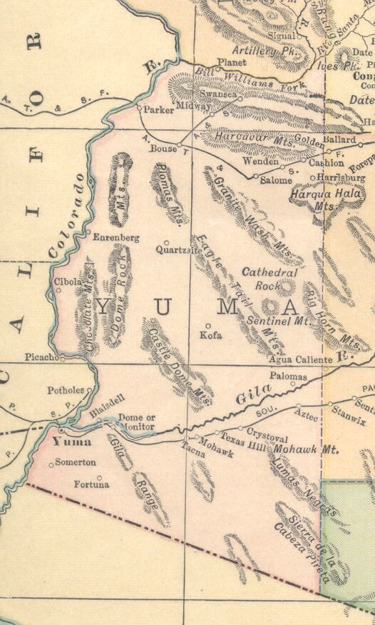
1895
1914
Courtesy of ghosttowns.com
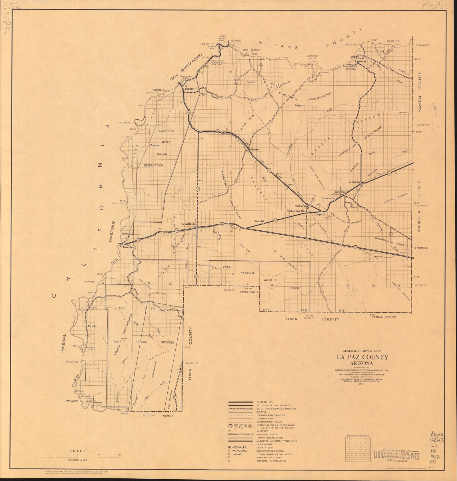
1982
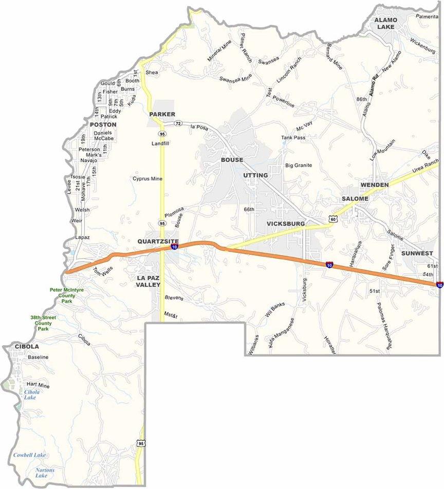
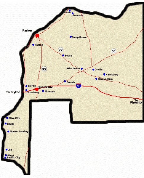
Courtesy of uscountymaps.com
At one time Alamo Crossing on the Bill Williams River from Mohave to Yuma County was an important place, but by 1953 only two individuals were living there. The name derived from the former presence of large cottonwoods. [*1]
Originally named for John Brayton Martin, who kept the Brayton Commercial Company, part of the Harqua Hala Mine. Brayton post office, established in 1906, was changed to Bouse in 1907 at the request of local citizens. The settlement was renamed for Thomas Bouse, a storekeeper or for George Bouse, a miner and gardener, or for both men.
Centennial took its name from its location on Centennial Wash (Yuma and Maricopa Counties) which is supposed to be one hundred miles long, including that portion which is also called Cullen Wash.
Apparently Centennial was an outgrowth of a place called Orville, which was on the Gila River near Palomas. The fact that this name gave way to Plomosa would seem to indicate that ores were handled at this place, since the Spanish meaning of Plomosa is "heavy metal." [*1]
In 1886 Capt. Charles Harris, a Canadian who had served with northern forces in the Civil War, started the town of Harrisburg in company with Gov. Frederick A. Tritle. The men hauled a five-stamp mill from Prescott to be used in connection with ores from the Socorro Mine and from other nearby mines. Harrisburg was established on the site of the old Centennial stage station, which on GLO 1892 shows as Harqua Hala.
At the Harrisburg cemetery (three miles west from Salome) there is a memorial to mark where Indians in 1849 massacred a party of California emigrants, whose bones were found months later by another party of gold-seekers. The finders carried the bones to the top of the Harrisburg cemetry knoll and buried them. [*1]
Post office 1887-1906.Formerly called Lockhart, the railroad station was renamed Love after WWI to honor Ernest Love, who had been killed in the conflict.
James McMullen was a stage driver on the route from Yuma to Ehrenberg. He later turned prospector, spending much of his time in McMullen Valley. Occasionally the name "Grace Valley" is applied to this area, for Grace Salome Pratt, whose husband (H. B. Pratt) tried to start and agricultural colony in the Salome portion of the valley. [*1]
Norton's Landing was a steamer landing on the Colorado River where supplies for the Red Cloud Mine were unloaded and where freight teams from Yuma stopped on their travels. George W. Norton (b. Indiana, August 9, 1843) came to Arizona in 1877 with the railroad construction crews, in charge of the building of the first bridge across the Colorado. Having finished that assignment, he turned mining man, owning the Pacific and the Silent mines. He still later entered politics and took up farming, following those activities with real estate interests in Yuma in 1912. [*1]
Originally this location near the La Paz Ferry was called Olivia and was so named, according to one reference, by Myron Angel, who was the founder of the town and who wished to honor Olive Oatman. Olive City was perhaps better known by the name Bradshaw's Ferry, which was operated by William D. Bradshaw and his brother Isaac. Travelers who crossed the COlorado at this place found that Olive City was merely one house about twelve by ten feet, which was covered with brush and sided with willow poles. Considering its flimsy construction, it is no wonder that all signs of this single building have long since disappeared. The ferry crossing was typical of many along the lower Colorado River. [*1]
renamed Centennial near its last days
Named in 1871 for General Eli Parker, Commissioner of Indian Affairs, at the same time as a post office was established on the Colorado River Reservation. The name appears on an 1879 General Land Office map. In 1905 the town was relocated four miles upstream next to the railroad crossing. The engineer in charge was Earl H. Parker. Incorporated in 1948. Became the county seat for La Paz County in 1983.
The Planet Mine, one of the first copper mines to be worked to any extent by Americans in Arizona, was discovered in April 1864 by Richard Ryland. The small community which sprang up about the mine took the name Planet. A way station for travelers soon developed which lasted for many years. [*1]
Mining in the Plomosa District began as early as 1862 with a great deal of placer gold being found during the early days. [*1]
Spanish name meaning "lead-colored" derived from the Plomosa Mountains where many lead-bearing mines exist.
Named for Charles Debrille Poston, first Superintendent for Indian Affairs in Arizona and directly responsible for the establishment in 1865 of the Colorado River Reservation on which this place is located.
During World War II, Poston was created as a relocation camp for twenty thousand Japanese. Today it is one small building which is used as a post office for residents of the area. [*1]
The town of Quartzsite is located on the site of old Fort Tyson, a privately owned fort built in 1856 by Charles Tyson for protection against Indians. Because of the water which existed at this place, Tyson's Wells soon became a stage station on the road from Ehrenberg to Prescott. In 1875 Martha Summerhayes described this place as being the most melancholy and uninvinting that she had seen, aying that it "reeks of everything unclean, morally and physically..." [*1]
In 1897 the development of mining in the area resulted in a small boom. It was reported that Tyson's Wells had three stores, two saloons, and a short-lived post office. [*1]
Located in Ehrenberg
It is probable that the correct spelling of William Rhodes' name is Rodes or Roods. Rhodes had a ranch just above the Barriers, a rapid in the Colorado River and the name is "Rhodes" on maps showing the location. In a newspaper article the name is spelled William B. Roods.
When Rhodes first came to Arizona from Kentucky in 1855, he had a cattle ranch in southern Arizona (Santa Cruz). He left the valley because of trouble wtih Indians and established a ranch on the Colorado River. During a rising flood on April 29, 1870, Rhodes drowned while attempting to cross the Colorado with a companion named Poindexter, who also drowned. Their boat struck a snag and capsized.
Rhodes' Ranch was still in fairly good condition in 1899, but it has since been destroyed by treasure seekers as a result of rumors of treasure hidden somewhere either in or near the old adobe house. This is today the location of Cibola. [*1]
Settlement established in 1904 by Charles H. Pratt and named for his wife, Grace Salome Pratt.
Charles Silent was an Associate Justice of the Territorial Supreme Court in 1880.
The town of Silent was named for the Silent Mining Claim in the Silver Mining District. A small smelter erected at Silent in 1880 operated intermittently for about three years. The Silver Mining District was not active until 1879 at which time George Sills, Neils Johnson, George W. Norton, and Gus Crawford relocated many of the claims which had been abandoned, and organized this district. [*1]
Originally known as Signal, the name was changed to Swansea when a smelter was built here.
This is a former railroad siding named for Charles Utting, a Rough Rider in the Spanish-American War.
When Victor E. Satterdahl, storekeeper, applied for a post office in the 1890's, he used his own first name as the root of the name for the post office. He was the first postmaster when the pot office was established in 1906.
Established as Wendendale in 1905 by Otis E. Young for his farm in Pennsylvania when a post office was established. The name of the post office was shortened to Wenden in 1909.
Josiah Winchester owned the Desert Mine in this locality. [*1]
[*1] Extracted 28 Jul 2017 from Arizona Place Names, published in 1960.
Copyright © 1996- The USGenWeb® Project, AZGenWeb, LaPaz County

This page was last updated
07/12/2026